Your privacy is important to us.
This website uses cookies to help deliver its services. By using this website, you agree to the use of cookies as outlined in our Privacy Policy.
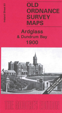
Alan Godfrey Map: Ardglass & Dundrum Bay 1900
Ireland Sheet 61
This Inch to the Mile map covers the County. Down coast around Dundrum Bay, with coverage stretching from Ardglass southwards to Annalong.
The map includes the seaside resort of Newcastle, Dundrum Castle, Tyrella sands where the great steamship, Great Britain, was beached, and the busy fishing port of Ardglass. On the reverse is a detailed map of Ardglass, showing the station, harbour, various castles, tramway, etc.
Towns and principal villages or church parishes which are included on this map:
County Down: Annalong, Ardglass, Dundrum, Killough, Maghera, Newcastle, Tyrella.
__
Local knowledge, a friendly community and support in your research: NIFHS Branches

 Login
Login Basket

